

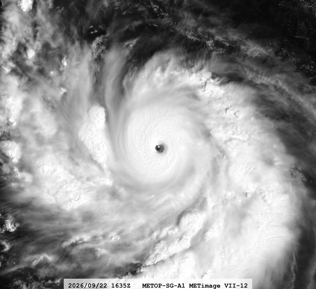
Major Pacific hurricanes can intensify quickly in late summer, especially when ocean heat and favorable upper-level conditions align. That pattern came into focus off Mexico this week as Hurricane Polo surged to Category 5 strength and then began turning away from the country’s southwestern coastline. Even with the center forecast to remain offshore, Mexican authorities and U.S. forecasters said the storm still posed serious coastal and rainfall hazards.
Polo became a Category 5 hurricane off Mexico on Sept. 22
Hurricane Polo strengthened into a Category 5 storm on Tuesday, Sept. 22, according to the National Hurricane Center and reporting from The Associated Press. The center said Polo’s maximum sustained winds reached 165 mph, placing it at the top of the Saffir-Simpson scale. AP reported that a NOAA Hurricane Hunter aircraft update described the cyclone as “extremely dangerous” as it tracked off southwestern Mexico.
By Tuesday night, AP reported Polo was centered about 210 miles south of Zihuatanejo and was nearly stationary over the Pacific before an expected turn. The National Hurricane Center said the storm was forecast to begin a slow but sharp turn to the northwest and then continue generally west-northwestward over the following days. That track kept the core offshore, but forecasters did not remove the immediate coastal risks tied to rain bands, surf and wind.
NASA’s MODIS website said the storm underwent extraordinary rapid intensification between Sept. 21 and Sept. 22. NASA said Polo’s central pressure fell to 892 millibars, making it the second-strongest hurricane on record in the Eastern Pacific by that measure, behind Hurricane Patricia. NASA also said Polo’s winds reached 180 mph at peak intensity during that period, underscoring how fast conditions changed offshore.
The clearest impacts were concentrated along Mexico’s southwestern Pacific coast, especially in Guerrero and Michoacán. AP reported that Mexican authorities temporarily suspended classes Tuesday in several areas, while the navy shut down ports in both states and warned civilians and fishermen to use caution. Reuters photo coverage from Acapulco on Sept. 22 also documented National Guard personnel giving safety recommendations on beaches as officials activated disaster-response measures.
Forecasters said the most immediate threat onshore came from water, not a direct landfall. AP reported the National Hurricane Center forecast 4 to 8 inches of rain, with isolated totals near 12 inches, across coastal parts of Guerrero and Michoacán through Thursday. That rainfall outlook raised the risk of flooding and mudslides, especially in steep or already saturated terrain.
What remains unconfirmed is the full extent of localized damage while the storm stays offshore. Authorities had not publicly released a comprehensive coastwide list of business closures, infrastructure impacts or evacuation totals at the time of the latest reports. The forecast track reduced the odds of the eye crossing land, but it did not eliminate the threat from outer bands, dangerous seas and fast-changing local conditions.
Forecasters and satellite agencies attributed Polo’s jump in strength to unusually favorable environmental conditions over the eastern Pacific. NASA said the storm intensified over very warm ocean water and reached historic levels for the basin in less than 24 hours. National Hurricane Center forecast discussions later said Polo began its turn while still in a supportive environment, but that conditions were expected to become less favorable as the system moved farther northwest.
AP also tied Polo’s path to a forecast change that had been signaled early in the week. On Monday, AP reported the hurricane was moving east before forecasters said it would make a sharp turn toward the west-northwest or northwest by late Tuesday, keeping it along the Mexican coast but offshore. That shift mattered because it changed the outlook from a possible closer coastal approach to a skirting scenario with indirect but still dangerous effects.
For residents and travelers along the Pacific coast, the practical takeaway remained consistent: hazardous beach conditions, rough surf, heavy rain and port disruptions could continue even without landfall. The National Hurricane Center said Polo was expected to weaken as it moved into less favorable conditions, but as of the latest advisories, the storm remained a major hurricane capable of producing dangerous weather along parts of Mexico’s coast.