
The Southwest is entering one of its most volatile fire weather stretches of the year. In many areas, the ingredients for explosive wildfire behavior are already in place, and forecasters say conditions can worsen within hours as wind, heat, and bone-dry air overlap.
Why the Fire Threat Is Rising So Quickly

Fire danger in the Southwest rarely hinges on a single factor. It builds when multiple hazards align at once, and that is exactly what forecasters are watching now across Arizona, New Mexico, Utah, Nevada, and nearby parts of the Four Corners. The National Weather Service has warned that hot, dry, and windy conditions continue to support a critical fire weather threat from the Southwest into the Great Basin, while the National Interagency Fire Center says elevated fire weather is persisting across much of the region.
What makes the current setup especially concerning is how little margin for error exists once the atmosphere turns hostile. In the Southwest Area, Red Flag conditions are generally tied to a combination of very low humidity, strong winds, and fire danger ratings high enough to support extreme behavior. Guidance used by the National Weather Service in the region defines a Red Flag event as conditions lasting at least three hours with sustained 20-foot winds of 20 mph or higher or gusts to 35 mph or higher, relative humidity at 15% or lower, and high or worse fire danger. That threshold is not abstract. It describes the kind of environment where a spark from a vehicle, power tool, dragging chain, or unattended campfire can become a fast-moving incident.
The numbers already tell a broader story about how active the year has been. As of Tuesday, June 9, 2026, the National Interagency Coordination Center listed 31,909 year-to-date wildfires nationwide and more than 2.5 million acres burned. The Southwest geographic area was at Preparedness Level 3, meaning regional strain is rising even though the national preparedness level remained at 2. Preparedness levels matter because they reflect not just fire count, but weather, fuels, fire behavior, and competition for crews, aircraft, and command resources.
This is why forecasters and fire managers focus so much on hourly deterioration. When humidity plunges into single digits by afternoon, temperatures surge, and gusty southwest winds increase over exposed terrain, fire behavior can shift abruptly from manageable to dangerous. A fire that creeps in the morning can begin spotting, torching, and making uphill or wind-driven runs later the same day. In the Southwest, the change can be rapid enough that response decisions made at noon may need revising by midafternoon.
The Weather Pattern Behind the Danger

The current threat is being driven by a classic early-summer Southwest fire weather pattern: a dry upper-level trough, deep daytime heating, and strong mixing of the atmosphere. That mixing pulls very dry air to the surface, drives down humidity, and helps stronger winds aloft reach the ground. The result is the kind of afternoon environment firefighters fear most, especially before the monsoon establishes itself in a reliable way.
Recent National Weather Service forecast discussions for New Mexico highlighted exactly that sequence. Forecasters described single-digit humidity spreading across much of the state, breezy to gusty southwest winds, and increasing concern for critical fire weather along and west of the Continental Divide. They also warned that scattered virga showers and isolated dry storms could create new starts, with stronger winds likely to continue into the following day. Dry thunderstorms are particularly dangerous because they can deliver lightning with little or no rain reaching the ground, while downdrafts produce erratic gusts that push flames in unpredictable directions.
The National Fire News report for June 5 added more detail across the broader region. It projected minimum relative humidity of 5-15% across Arizona, Utah, and Nevada, combined with southwest winds of 10-20 mph and gusts up to 30-35 mph, strongest in southern Nevada, southwest Utah, and northwest Arizona. Those are not extreme numbers by Southwest standards, but in cured grasses, brush, and drought-stressed timber understories, they are more than enough to create rapid rates of spread. Warm temperatures then compound the problem by drying fine fuels even further during the hottest part of the day.
This is also a transitional period in the seasonal cycle, which often produces some of the most unstable fire behavior of the year. Spring green-up has faded in lower elevations, but widespread monsoon moisture has not yet arrived to moderate the landscape. That gap leaves fuels exposed to prolonged drying. Fine fuels such as grasses and light brush respond quickly, sometimes within hours, which is why the phrase “getting worse by the hour” is not exaggeration. As the boundary layer deepens through the afternoon, the atmosphere can effectively load the dice in favor of ignition and spread.
Even areas that saw some rainfall earlier in late spring are not necessarily protected. The Southwest outlook from the National Interagency Coordination Center notes that while parts of southeast Arizona, the Continental Divide, and southern New Mexico received strong rainfall in May, much of western Arizona remained drier than normal. Lightning activity also increased initial attack activity. In practical terms, scattered rain may have temporarily improved some pockets, but not enough to erase the broader regional fire danger.
Why June Is Such a Critical Month in the Southwest

June is often the hinge point between the relatively dry spring fire season and the hoped-for moderation of the summer monsoon. This year, predictive services expect significant fire potential to increase through the month as the region moves deeper into its core fire season. According to the latest national outlook, June is trending warmer and drier across western Arizona and much of New Mexico, where fuels are already considered receptive to ignition and spread.
That phrase, “receptive fuels,” is central to understanding risk on the ground. It means vegetation is dry enough that when an ignition source appears, the landscape is ready to burn. In western Arizona, that can include flashy grasses and desert shrubs that carry fire faster than many people expect. In New Mexico, it can mean a mix of grass, brush, and forest fuels that support both rapid surface spread and more intense runs under wind. When forecasters say potential is rising in June, they are not only talking about more fires starting. They are also talking about a higher chance that some of those fires escape initial attack.
The seasonal outlook goes further, warning that fire potential in the Southwest is expected to peak in late June through early July. That window is especially dangerous because critically dry fuels, above-normal temperatures, and periodic dry thunderstorms may align before deeper monsoon moisture becomes widespread. In other words, the same storms that hint at a coming seasonal change may first arrive as dry lightning producers with gusty outflows, creating new ignitions and fanning existing fires.
There is also a broader climate signal reinforcing concern. The outlook notes strong probabilities for above-normal temperatures across Arizona, New Mexico, and much of the West in July, with some areas showing a 60-70% likelihood of warmer-than-average conditions. Even if the monsoon arrives on time or slightly early in parts of New Mexico, uneven rainfall distribution can leave large areas vulnerable. One mountain range may get soaking storms while a nearby valley remains dangerously dry for days or weeks.
That unevenness matters for communities as much as wildlands. Residents often assume one burst of rain lowers the risk across an entire state, but wildfire danger does not reset that cleanly. Lightning can start holdover fires, wind can dry grasses again in a day, and storm outflows can spread flames far from the original ignition point. June is the month when those contradictions are most visible: the atmosphere hints at relief, but often delivers volatility first.
What This Means for Firefighters and Communities
For firefighters, escalating critical fire weather means strategy becomes more defensive and more complex. Wind-driven fire can outrun direct attack, especially in steep terrain or in areas with continuous grasses and brush. Aircraft may be grounded or limited when turbulence and gusts become too severe, and crews may have to prioritize structure protection, evacuation support, and point protection instead of aggressive line construction on the most active flanks.
Preparedness levels help reveal that growing pressure. The Southwest’s current Preparedness Level 3 indicates that activity and demand are high enough to elevate regional concern, even before the heart of summer. That does not mean every community is in immediate danger, but it does mean agencies are watching resources carefully. If multiple new starts occur during a widespread wind event, dispatch centers can feel the strain quickly. A day with several human-caused ignitions and a few lightning starts can stretch engines, hand crews, aviation assets, and incident management capacity much faster than the public realizes.
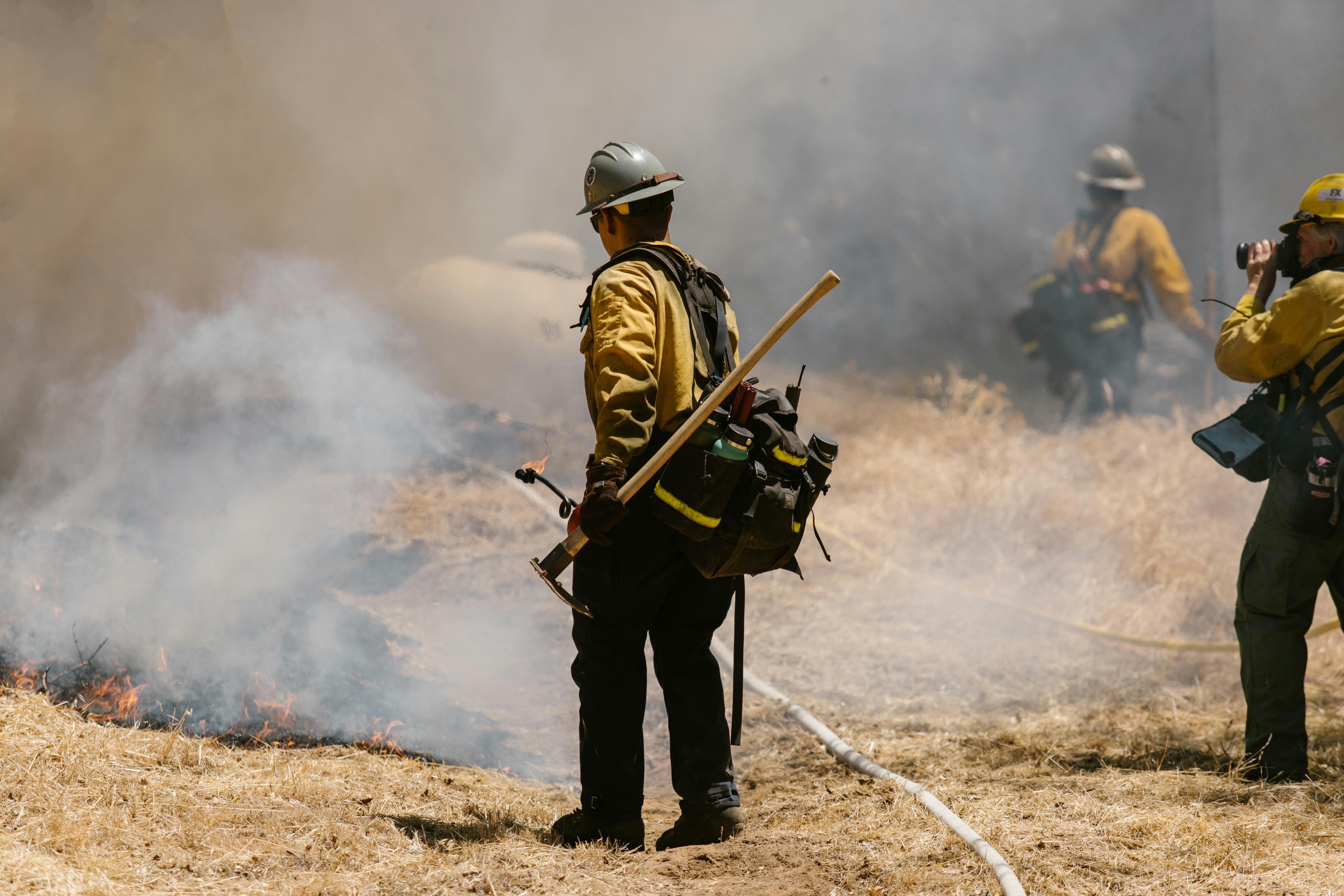
For communities, the immediate risk is not limited to people living next to forests. Some of the most dangerous fast-moving fires in the Southwest begin in grass and brush near highways, subdivisions, utility corridors, recreation sites, or tribal and rural lands. The National Fire Center continues to emphasize that many U.S. wildfires are human-caused and preventable, with common sources including escaped debris burning, unattended campfires, and sparks from vehicles or equipment. In a pattern this dry, even routine activities can become consequential.
Smoke is another serious part of the hazard. Even when a fire remains relatively small, shifting winds can push dense smoke into population centers, highways, and mountain passes. That creates respiratory risks for older adults, children, and people with asthma or heart disease, while also reducing visibility for drivers and aircraft. Communities may feel the effects of a fire before flames are ever visible from town, especially when overnight drainage winds carry smoke into valleys.
The larger takeaway is that “critical fire weather” is not technical jargon meant only for meteorologists. It is a public warning that the environment is primed for rapid fire growth. During such periods, response time matters, but prevention matters even more. When weather, fuels, and topography are aligned, the safest fire is the one that never starts.
How Conditions Could Change in the Days Ahead

The near-term outlook suggests the Southwest will remain vulnerable until more consistent moisture disrupts the current pattern. National outlooks indicate that conditions may improve first in parts of New Mexico as monsoon moisture gradually increases, with Arizona potentially seeing broader benefits later as the monsoon shifts westward into August. But that does not offer much immediate comfort for the next several weeks, when the atmosphere can still produce repeated rounds of low humidity, strong wind, and dry lightning.
That timing is important because transition periods are often messy rather than clean. The monsoon does not switch on like a faucet. It develops in pulses, with some areas seeing early thunderstorms while others remain under hot, dry southwest flow. Those first storms can be more dangerous than beneficial if rainfall is light and lightning is frequent. Outflow winds can push existing fires in new directions, send embers across containment lines, and create sudden flare-ups far from the main front.
For the public, the best response is practical and immediate. Avoid any activity that can throw sparks, postpone equipment use during the hottest and windiest part of the day, and pay close attention to local Red Flag Warnings and fire restrictions. Travelers should remember that towing chains, overheated brakes, parked vehicles over dry grass, and target shooting can all start fires. Homeowners in fire-prone areas should clear fine fuels near structures, review evacuation plans, and keep alerts enabled on their phones.
The broader fire season still has time to evolve, and forecasts beyond a week always carry uncertainty. Yet the current direction is clear enough: June 2026 is pushing the Southwest deeper into a dangerous pre-monsoon fire window. With year-to-date fire totals already above 10-year averages nationally, with the Southwest at Preparedness Level 3, and with weather agencies warning of continued hot, dry, windy conditions, this is a period that demands attention rather than complacency.
In the Southwest, wildfire danger often accelerates invisibly before it becomes dramatic on camera. Humidity drops first. Winds strengthen next. Fuels cure further under heat. Then one ignition finds the wrong slope at the wrong hour. That is why the threat can feel as though it is worsening by the hour — because, in operational terms, it often is.