
The ground moved with extraordinary force, and within minutes the scale of the disaster was clear. In the southern Philippines, a 7.8-magnitude earthquake has left communities grieving, infrastructure damaged, and emergency agencies racing to reach the hardest-hit areas.
A major offshore quake turns into a national emergency

The earthquake struck off Mindanao, with the U.S. Geological Survey locating it near Kablalan in the southern Philippines at magnitude 7.8. That magnitude immediately placed it among the country’s most powerful earthquakes in decades, and early reporting from the Associated Press described collapsed structures, injuries, and a tsunami reaching nearby coasts. Initial casualty figures moved quickly as rescuers assessed the damage, a reminder that death tolls after major quakes often rise in the first 24 hours as remote areas report in and hospitals process the most serious injuries.
What made this event especially alarming was not just the number on the magnitude scale, but the combination of offshore origin, coastal exposure, and population density in affected areas. Mindanao is home to millions of people, with towns and cities spread across shorelines, valleys, and steep terrain vulnerable to both landslides and secondary hazards. AP reported that the quake sent residents running from homes and public buildings, while local damage included fallen walls, cracked structures, and disrupted roads. In strong earthquakes, even buildings that remain standing can become unsafe because of hidden structural failure.
The tsunami risk added another layer of fear. AP reported waves of about 1 meter hitting some nearby coasts after the quake, underscoring how offshore seismic events can rapidly compound destruction. In coastal communities, people are often forced to make split-second decisions about whether to flee inland, seek higher ground, or shelter in damaged surroundings. Those decisions are especially difficult at night or when communications fail, which is common after major shaking.
Emergency response in the Philippines is often complicated by geography. The country is an archipelago of more than 7,000 islands, and even within Mindanao, damaged bridges, landslides, and power outages can slow rescue work. That means the first official toll is rarely the final one. In disasters of this size, the earliest hours are defined by uncertainty: incomplete field reports, overloaded hospitals, and entire communities waiting to be counted.
Why this quake is being compared with 1976
The comparison to 1976 is not rhetorical. U.S. Geological Survey records show that one of the most consequential Philippine earthquakes of the modern era struck in November 1976 near Mindanao at magnitude 7.9, generating a tsunami and causing catastrophic loss of life. That disaster remains one of the defining seismic tragedies in Philippine history, both because of the size of the quake and because the tsunami multiplied its destructive reach far beyond the immediate rupture zone.
When a 2026 earthquake reaches magnitude 7.8 in roughly the same broad southern region, the historical echo is unavoidable. It does not mean the two events are identical; magnitude, depth, rupture mechanics, coastal exposure, and preparedness levels all shape outcomes differently. But seismologically, a 7.8 event is in the same upper tier of destructive earthquakes that can trigger widespread building damage, landslides, port disruption, and dangerous sea-level disturbances. For Philippine officials and residents, 1976 is the benchmark disaster that still shadows every major offshore quake in Mindanao.
The phrase “strongest since 1976” also reflects a reality about earthquake rarity. The Philippines experiences frequent seismic activity because it lies on the Pacific Ring of Fire, but truly great or near-great earthquakes are much less common than moderate tremors. Smaller earthquakes may damage a town or province; a 7.8 event can threaten multiple provinces at once, particularly when it occurs offshore and sends strong shaking across a broad swath of coastline. It is the kind of quake that tests not only local response, but national resilience.
Historical comparisons matter because they shape public behavior. In the Philippines, memories of past disasters influence evacuation choices, media framing, and government posture. A quake linked in public discussion to 1976 is instantly understood as more than a routine tremor. It signals a potentially defining national event, one that will likely be studied for years by engineers, planners, and disaster agencies trying to understand what failed, what held, and what must change.
The human toll, building damage, and the hidden danger after the shaking
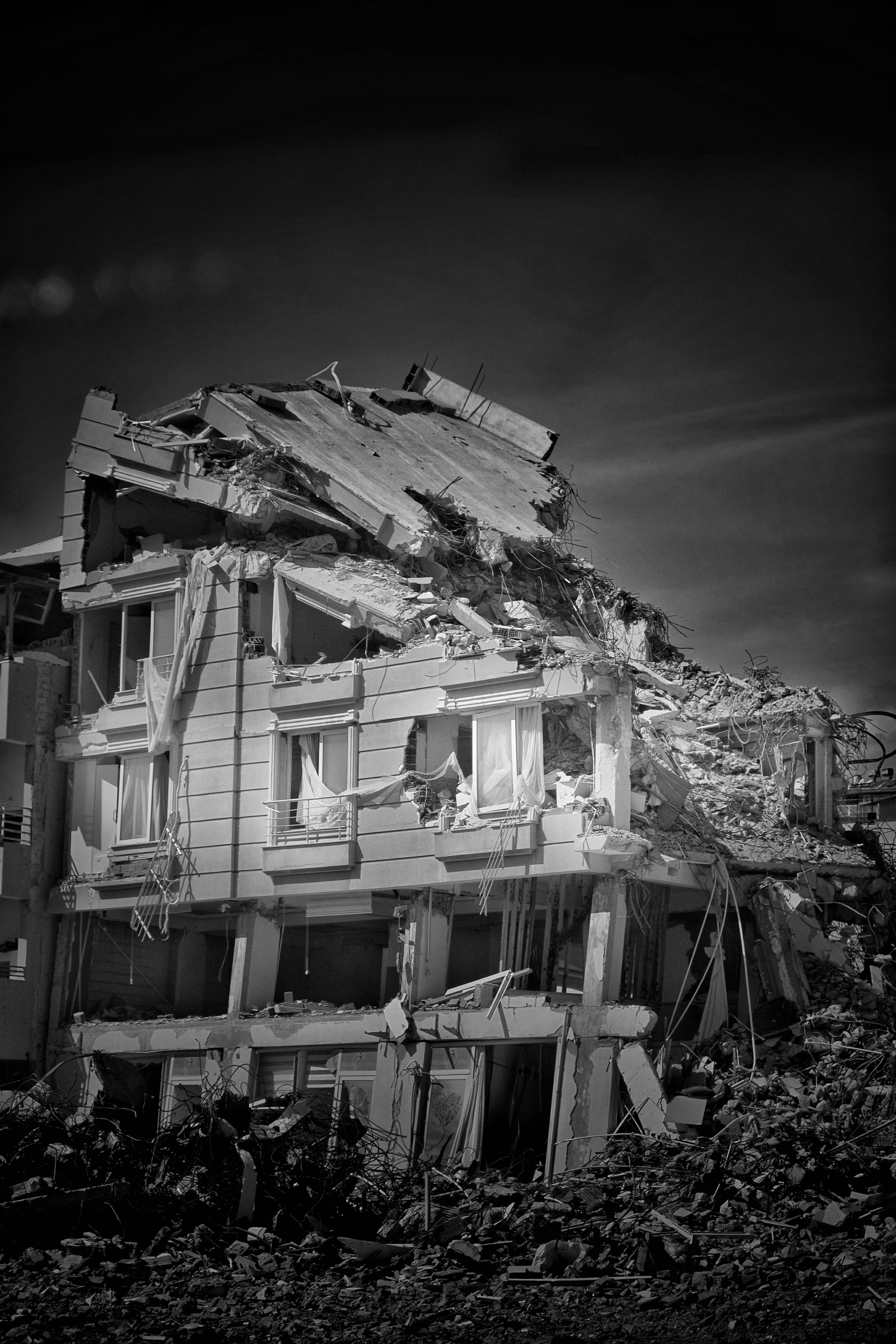
As with most large earthquakes, the direct shaking was only the start of the danger. AP reported fatalities from both structural collapse and a landslide in Sarangani province, showing how earthquake deaths often result from a chain of impacts rather than a single mechanism. A person can survive the initial tremor only to be endangered minutes later by falling masonry, unstable slopes, damaged roads, or aftershocks that bring down already weakened buildings.
Public buildings, schools, hospitals, and transport corridors are often the most consequential sites of damage because they are central to response. If a hospital is cracked or loses power, the emergency burden shifts instantly to neighboring facilities. If roads are blocked, rescue teams cannot reach trapped residents quickly enough. If ports are disrupted in an island nation, heavy equipment and relief supplies may take much longer to arrive. These are the less visible consequences that turn a severe earthquake into a prolonged humanitarian emergency.
Another major concern is the condition of buildings that did not fully collapse. Engineers frequently find that columns, beam connections, or foundations suffer deep structural stress even when exterior walls remain intact. Residents, however, may re-enter because they need medication, documents, food, or simply shelter. That is why post-quake cordons and inspections are so important. The period after the main shock can be deceptively dangerous, especially when strong aftershocks strike and compromised buildings fail without warning.
There is also the psychological shock. Survivors of powerful earthquakes often describe the event not just as frightening, but disorienting in a way storms are not. The earth itself, assumed to be stable, becomes unpredictable. In the Philippines, where many families already live with recurring typhoons, flooding, and volcanic risk, a major earthquake layers one disaster onto an already high baseline of vulnerability. For children, older adults, and people with disabilities, the recovery burden can become especially severe if homes are destroyed and basic services remain disrupted for days.
Why the Philippines remains so exposed to extreme earthquakes

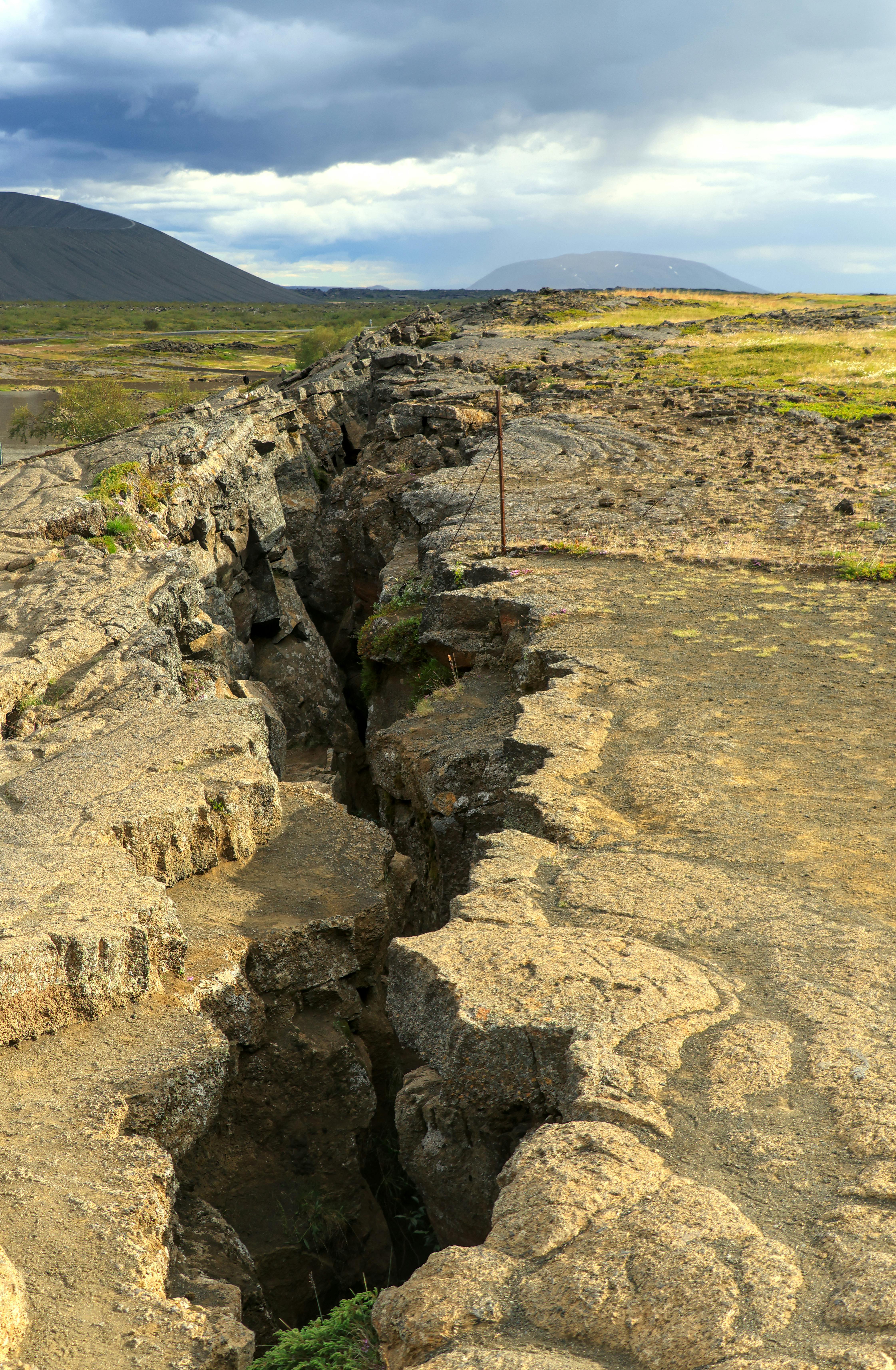
The Philippines is one of the most disaster-prone countries in the world because its geology is unforgiving. It sits along active plate boundaries and complex fault systems shaped by the interaction of major tectonic plates and smaller microplates. This setting produces earthquakes, volcanic eruptions, and tsunami risk in close combination. A quake in one part of the country may be felt lightly elsewhere, but major events near populated coastal zones can become nationally significant within minutes.
Mindanao, in particular, has a long history of destructive earthquakes. Offshore trenches, active faults, and steep terrain create the conditions for both strong shaking and secondary hazards such as submarine displacement and landslides. The problem is not simply that earthquakes happen often; it is that people, buildings, and essential infrastructure increasingly occupy exposed areas. Coastal development, informal housing, and uneven enforcement of building standards can all increase casualties even when warning systems and public awareness have improved.
Preparedness has advanced since the 1970s, but vulnerability remains uneven. Urban centers may have better emergency management, more robust communication systems, and stricter engineering oversight than smaller municipalities. Yet a major quake does not respect those differences. It can sever roads between towns, overload cellular networks, and leave rural communities isolated just when they need rapid medical evacuation. In that sense, seismic risk in the Philippines is as much about inequality and infrastructure as it is about tectonics.
The offshore nature of this earthquake is a critical reminder that the most dangerous Philippine quakes are not always those directly beneath major cities. An offshore rupture can spread shaking across wide coastal regions and generate sea hazards with almost no delay. That combination leaves residents confronting two threats at once: what falls from above and what may surge in from the sea. Disaster planners have long understood this, but every powerful event exposes the gap between planning on paper and survival in real communities.
What comes next for rescue, recovery, and long-term policy

In the immediate aftermath, the priority is lifesaving work: search and rescue, trauma care, temporary shelter, and rapid inspection of critical infrastructure. Officials must determine which hospitals can still function, which schools can serve as evacuation centers, and which roads remain passable for heavy equipment. In coastal areas, authorities also have to monitor whether families who fled tsunami warnings can safely return, especially if power and water systems remain unstable.
The next stage is more difficult because it stretches from days into years. Engineers will inspect homes, bridges, government buildings, and commercial structures to decide what can be repaired and what must be demolished. Economists and local officials will measure losses to ports, fishing communities, agriculture, and small business activity. For many families, however, recovery is less abstract: it means finding rent money, replacing lost belongings, and coping with grief while aftershocks keep nerves on edge. Earthquakes are sudden, but recovery is long.
This disaster is also likely to reignite debate over building codes, land-use planning, coastal evacuation protocols, and public education. The Philippines has repeatedly shown resilience after typhoons and volcanic crises, yet earthquakes expose a different kind of weakness because there is often little or no warning before violent shaking begins. That places enormous importance on what has been done beforehand: retrofitting schools, enforcing safer construction, identifying landslide-prone zones, and rehearsing tsunami evacuation routes.
The broader lesson is stark. A 7.8 earthquake is not simply another entry in the country’s long disaster record; it is a national stress test with historic resonance. With USGS records pointing back to the devastating 1976 Mindanao quake and AP documenting the scale of the latest destruction, the message is clear: the Philippines remains on the front line of seismic risk. Whether the death toll ultimately settles lower or climbs higher, this earthquake has already become a defining warning about what extreme geological exposure means in a densely populated island nation.