

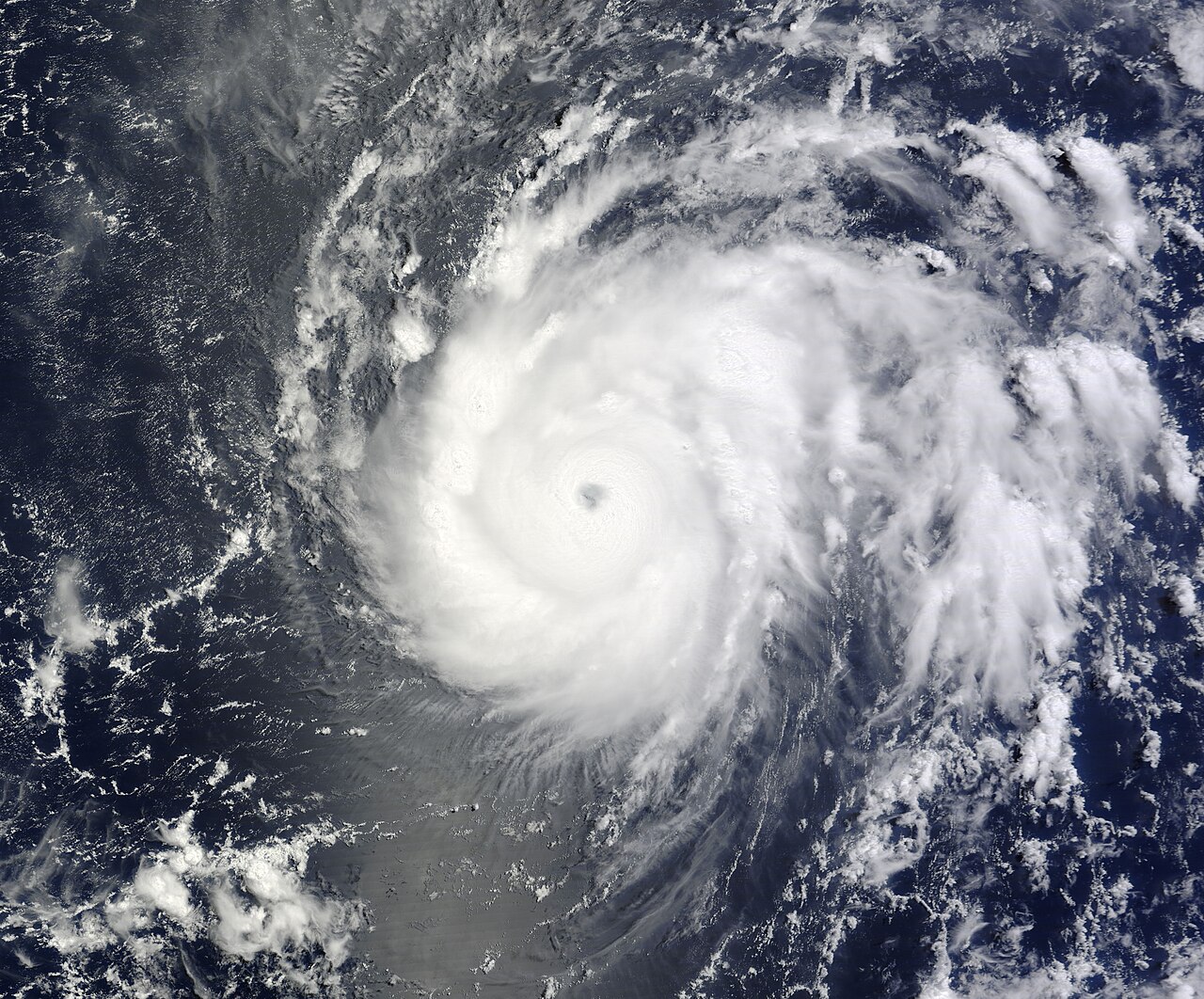
The 2026 Eastern Pacific hurricane season produced its first Category 5 storm in late July as unusually fast strengthening again drew attention to how quickly tropical cyclones can intensify over warm ocean waters. Hurricane Genevieve, which developed south of Mexico, doubled its peak sustained winds from 80 mph to 160 mph in under 30 hours, according to National Hurricane Center advisories issued between the evening of July 25 and early July 27. By Tuesday, July 28, the storm had weakened back to Category 4 strength, but forecasters said swells from the system were still affecting parts of Mexico’s southwestern coast and the Baja California peninsula.
Genevieve’s rapid intensification pushed it to 160 mph on July 27
The National Hurricane Center upgraded Genevieve to a hurricane at 8 p.m. MST on Saturday, July 25, with maximum sustained winds of 80 mph, according to Discussion No. 7. Less than 30 hours later, the center reported that Genevieve had reached 160 mph, making it a Category 5 hurricane on the Saffir-Simpson scale. That made Genevieve the first Category 5 hurricane of the 2026 Eastern Pacific season, and AP reported it was the first in the East Pacific region in two years.
Forecast discussions from the hurricane center showed a sharp upward trend even before the storm reached its peak. By 8 a.m. MST on Sunday, July 26, Genevieve had already strengthened into a major hurricane, and official forecasts soon projected it near 150 mph. The center’s analyses cited a more organized inner core and favorable outflow as the system intensified over open water.
By early Monday, July 27, Genevieve’s pressure had fallen into the 920s millibars as its wind field tightened around a distinct eye, a sign of a very intense cyclone. AP later reported that the hurricane was only briefly at Category 5 intensity before fluctuating downward. By early Tuesday, the storm had weakened to Category 4 with sustained winds near 140 mph.
Genevieve remained well offshore through its peak, moving on a track roughly parallel to Mexico’s Pacific coast rather than directly toward land, according to the National Hurricane Center and AP reporting on July 27 and July 28. No coastal watches or warnings were in effect during that period. The storm’s center stayed several hundred miles from the southern tip of the Baja California peninsula even as it maintained major hurricane strength.
What was confirmed by forecasters was the marine hazard, not a landfall threat. The hurricane center said swells generated by Genevieve were affecting parts of Mexico’s southwestern coast and Baja California, with life-threatening surf and rip current conditions possible. Those impacts can occur far from a storm’s center, especially when a large major hurricane remains over open ocean.
What was not yet known from public advisories was any comprehensive local damage picture tied solely to Genevieve’s surf impacts along specific communities in Mexico. Public reports available through major wire coverage focused on forecast hazards and storm position rather than town-by-town effects. As of Tuesday, the main verified risk remained dangerous coastal water conditions rather than destructive core winds over land.
National Hurricane Center discussions tied Genevieve’s strengthening to a supportive environment that included warm sea-surface temperatures, relatively low to moderate wind shear, and a storm structure that became increasingly organized. In successive advisories, forecasters pointed to improving inner-core convection and well-established outflow, both of which help tropical cyclones efficiently vent rising air and intensify. Those official discussions are the clearest explanation for why the storm strengthened so quickly between July 25 and July 27.
The same forecast reasoning also explained why Genevieve was expected to weaken after its peak. In its July 28 discussion, the hurricane center said the storm was moving into a more marginal environment and would eventually cross cooler waters near the 26-degree Celsius threshold. Forecasters also cited decreasing mid-level moisture and signs that the eyewall structure was beginning to erode.
For residents, travelers and coastal communities, that meant the most immediate concern was surf and rip currents rather than a direct strike from the eyewall. The National Hurricane Center said Genevieve was expected to fluctuate in intensity in the short term before weakening later in the week. As of Tuesday evening, the official forecast called for continued decay over progressively cooler waters as the system stayed over the open Pacific.