

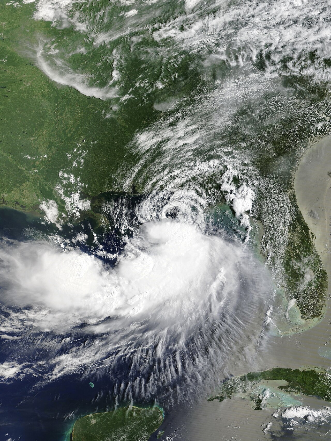
Tropical systems in the Gulf of Mexico can bring flooding far from where their centers come ashore, especially when slow movement and persistent onshore flow push water toward vulnerable coastlines. Tropical Storm Bertha is doing that this week, with federal forecasters and state officials warning of coastal flooding and heavy rain from the Florida Panhandle west to Louisiana. The storm strengthened Tuesday and was expected to move toward southeast Louisiana by Wednesday night, according to the National Hurricane Center and reporting from the Associated Press.
Bertha’s track and warnings stretch across the northern Gulf Coast
Tropical Storm Bertha was a 60 mph storm Tuesday as it moved west at about 6 mph in the Gulf, according to the National Hurricane Center’s public advisories carried by the National Weather Service and reported by the Associated Press. Forecasters said tropical-storm-force winds were spreading westward along the coast, and warnings extended from the Bay-Gulf County line in Florida to parts of coastal Louisiana. The National Hurricane Center also said moderate coastal flooding was expected in some areas where onshore winds and water levels aligned with the tide.
By Wednesday, the Associated Press reported that Bertha had weakened somewhat to 50 mph but was still forecast to make landfall Wednesday night in coastal southeast Louisiana, in a lightly populated area southeast of New Orleans. Michael Buchanan, a National Weather Service meteorologist in Louisiana cited by the AP, said wind was expected to be the storm’s biggest threat near landfall, though flooding remained a concern across the broader region. The system’s slow motion increased the time communities could remain under bands of rain and persistent coastal effects.
The official storm date tied to this phase of the event is July 21, 2026, when Bertha was identified in broad public reporting as a tropical storm strengthening in the Gulf and threatening multiple Gulf Coast states, according to the AP and National Weather Service products.
The confirmed impact zone extended from the Florida Panhandle across coastal Alabama and Mississippi into Louisiana, according to National Hurricane Center discussion products and local National Weather Service offices. In the Tallahassee forecast area, forecasters warned of squally weather, dangerous rip currents and minor coastal saltwater flooding in Florida counties. In Louisiana, the New Orleans-area forecast office said coastal flooding and tropical conditions were more likely closer to the projected track near the Louisiana coast.
What remains uncertain is how much inundation each community will see at high tide, because storm surge flooding depends on the exact timing of the surge, local elevation and where the strongest onshore winds set up. Federal advisories indicated the greatest rainfall risk was along the Gulf Coast from western Florida into southern Louisiana, with the potential for isolated flash flooding, especially in urban areas. Officials had not released a single comprehensive street-by-street list covering every affected Gulf Coast location as of Wednesday.
That means residents in Pensacola, Mobile, Biloxi and southeast Louisiana were all under some level of concern, but not all were facing the same risk at the same time. Forecast offices were updating local statements as Bertha moved west.
Forecasters have tied Bertha’s flood risk to a combination of slow forward speed, broad moisture and persistent onshore winds along the northern Gulf Coast. The National Hurricane Center said the storm was battling strong wind shear, which limited its organization, but that same setup still allowed rain bands and water piling along the coast from Florida to Louisiana. Weather.com and AP reporting both said the storm was expected to weaken over time even as it continued to produce hazardous coastal and rainfall impacts.
That distinction matters for residents because a weakening tropical storm can still generate disruptive flooding. National Weather Service forecast discussions in both Florida and Louisiana emphasized coastal flooding, rough surf, rip currents and periods of heavy rain rather than a worst-case inland wind event. In Louisiana, forecasters also indicated the flash flood threat appeared more limited than in some past storms, but not absent.
For Gulf Coast residents, the practical expectation was a stretch of unsettled weather, localized coastal inundation and changing advisories rather than one uniform impact across every shoreline community. As of Wednesday, forecasters continued to track Bertha toward southeast Louisiana while warning that coastal flooding and heavy rain could extend well away from the storm’s center.