
Flash flooding is once again becoming one of the most dangerous weather threats across the nation’s midsection. What makes this stretch especially concerning is not just the rain falling now, but the pattern behind it.
Why the flooding threat is so serious right now

The current flash flood threat across the Central Plains and Midwest is being driven by a weather setup that forecasters know well and worry about immediately: repeated thunderstorms moving over the same areas. The National Weather Service’s Weather Prediction Center has continued to highlight parts of the central Plains into the Ozarks and portions of the Upper Midwest in excessive rainfall outlooks, warning that storm clusters may produce localized but intense downpours capable of overwhelming drainage systems and small streams. In recent outlooks, forecasters have pointed to the risk of training storms, a term used when thunderstorms repeatedly pass over the same corridor like railroad cars on a track. That is one of the fastest ways to turn a typical heavy-rain event into a life-threatening flash flood emergency.
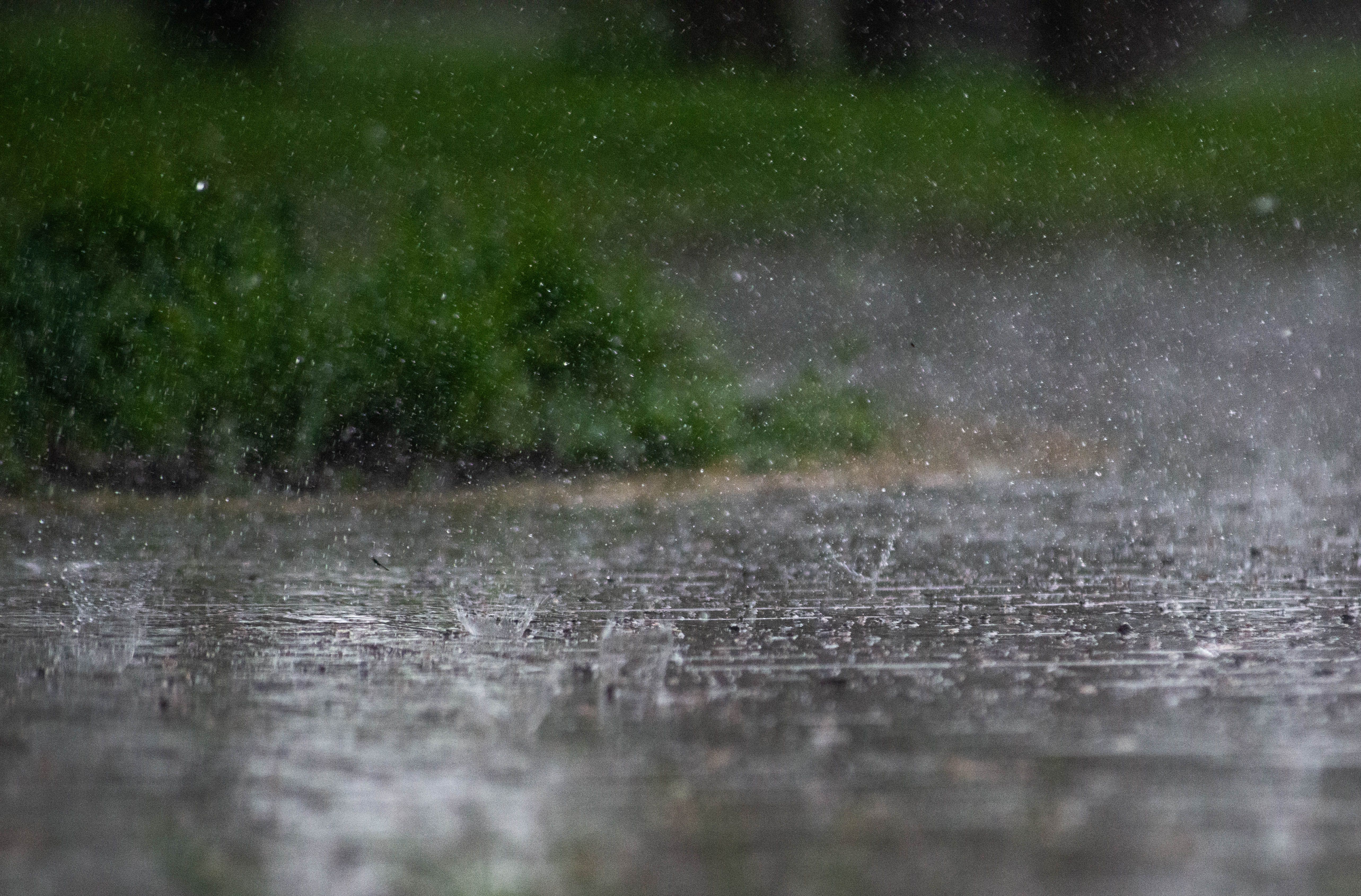
The atmosphere over the region is primed for efficient rainfall. Weather Prediction Center discussions this month have described very humid air with precipitable water values around 2″, an unusually moisture-rich setup for many inland areas, along with rain rates that can reach 2-3″ per hour in the most intense storms. Those numbers matter because even places that are not near a major river can flood quickly when that much water falls in a short time. Streets, underpasses, creeks, agricultural lowlands, and urban neighborhoods can all become dangerous in minutes, especially after sunset when drivers have a harder time judging the depth of water on roads.
This is also a broad regional problem rather than a single-city event. Forecast discussions have repeatedly referenced the central Plains, Mid-Mississippi Valley, Ozarks, western Tennessee Valley, and parts of the Upper Midwest as areas where overlapping ingredients may support flash flooding. In some places, the danger comes from fresh rounds of storms on already wet ground. In others, it comes from a single complex of storms that intensifies after dark, when mesoscale convective systems often mature and expand.
Reuters and Associated Press reporting on similar early-summer flood episodes has often underscored the same point meteorologists make every year: flash floods kill because they escalate faster than people expect. Tornadoes may dominate the headlines in the Plains, but water is often the more widespread hazard. A storm does not have to look historic on radar to produce a deadly outcome if it stalls over one community for an hour or two. That is why officials focus so heavily on the combination of rainfall rate, storm repetition, and local vulnerability rather than on storm totals alone.
The weather pattern behind repeated rounds of heavy rain
This is not simply a case of one strong thunderstorm line rolling through and moving on. The larger pattern features waves of energy moving across the Plains and Midwest, drawing on a persistent feed of Gulf moisture and interacting with warm, unstable air already in place over the region. Weather Prediction Center forecasts have noted that these upper-level disturbances are helping trigger new rounds of storms day after day, sometimes with one round laying the groundwork for the next by leaving behind boundaries that later storms can ride along. Those leftover boundaries often become focal points for renewed development, especially in the late afternoon and evening.
That process helps explain why the risk is not going away quickly. Even when one cluster of thunderstorms weakens, the atmosphere can reload by the next day if humidity remains high and the jet stream continues to send disturbances across the same corridor. Forecasters have also highlighted highly efficient rainfall processes, meaning storms do not need extreme wind or long duration to dump dangerous amounts of water. In practice, that can mean a town gets a brief break in the weather, only to face another round overnight or the following afternoon before waterways and soils have time to recover.
Soil moisture and antecedent conditions are a major part of the equation. National Weather Service discussions have specifically warned that parts of the Plains and Midwest may be more susceptible to flooding after prior-day rainfall, with wet soils increasing runoff and reducing the amount of rain the ground can absorb. Even areas that started the season relatively dry can become flood-prone after a few consecutive storm days. Once topsoil is saturated and ditches are full, additional heavy rain tends to run off quickly into creeks, tributaries, and urban drainage networks.
There is also a seasonal reason this pattern is so potent. Early summer is one of the most active times of year for nocturnal thunderstorm complexes in the central United States. Heat and humidity build during the day, low-level winds strengthen at night, and storms can organize into large clusters that keep producing heavy rain well after midnight. That overnight timing is especially dangerous because people are sleeping, visibility is poor, and emergency messages may not be seen immediately. The result is a prolonged flood risk window that extends beyond the afternoon severe weather peak and into the hours when people are least prepared to respond.
Which places are most vulnerable and why impacts can vary
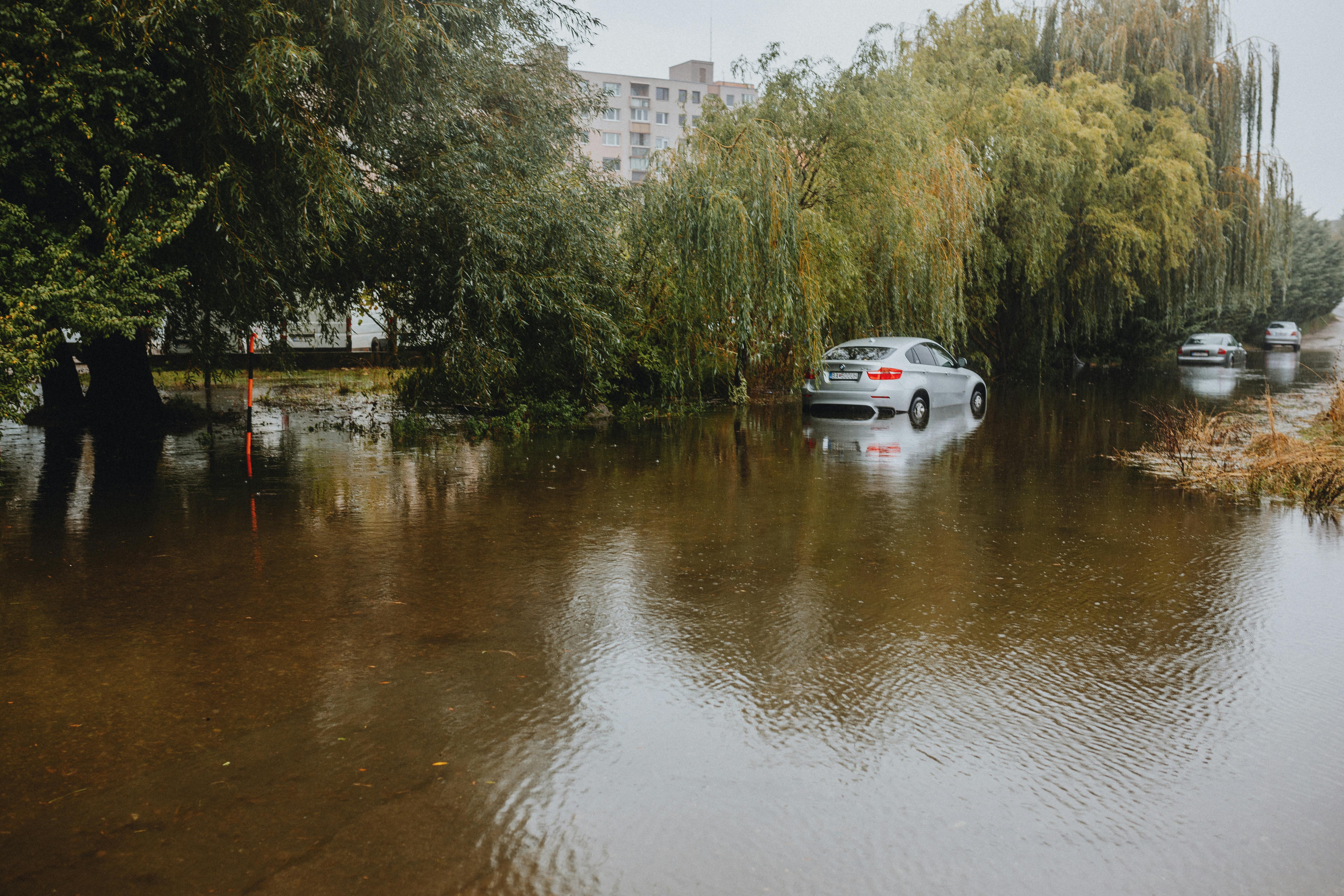
Not every community in the risk zone will experience flooding, but the places that do can be hit hard and fast. Low-lying roads, creek-adjacent neighborhoods, trailer parks, campgrounds, and urban corridors with aging stormwater systems are among the most vulnerable. In the Plains, rural areas face a different but equally serious problem: water can rise across farm roads, wash out culverts, and isolate homes that sit miles from the nearest paved highway. In the Midwest, a dense network of smaller rivers and tributaries can respond rapidly to intense rainfall, especially where development has reduced the amount of open land available to absorb runoff.
Urban flooding is often underestimated during these events. A city does not need to be next to a large river to suffer dangerous flash flooding if storm drains clog or are overwhelmed by rainfall rates of 2-3″ per hour. Parking lots, highways, basements, and underpasses can fill quickly. Water can back up into intersections and surge through neighborhoods that rarely think of themselves as flood zones. That disconnect is one reason flash flood warnings are sometimes ignored until conditions become visibly severe, by which point escape routes may already be limited.
Agricultural areas across Kansas, Nebraska, Missouri, Iowa, Illinois, and surrounding states face another layer of vulnerability. Fields that cannot absorb more water shed runoff into nearby creeks, and repeated storms can turn drainage channels into fast-moving torrents. Livestock operations, grain storage, and rural infrastructure all become exposed when heavy rain persists over several days. For farmers, the consequences go beyond the immediate flood, extending to delayed planting, soil erosion, nutrient loss, damaged access roads, and standing water that lingers long after the skies clear.
The impact also varies because flash flooding is intensely local. One county may receive manageable rainfall while a nearby town ends up beneath a stalled thunderstorm core. Weather Prediction Center outlooks are designed to identify the broader region where that is most likely, but they cannot tell every community exactly which street will flood first. That uncertainty is built into the hazard itself. It is why emergency managers emphasize readiness across the wider risk area, even when radar at midday does not yet show a major problem. In these setups, conditions can deteriorate from routine to dangerous in less than an hour.
Why the danger may persist beyond this week

The most important message from forecasters is that this is a pattern problem, not just a single storm problem. When the atmosphere remains humid, unstable, and supportive of repeated storm development, the flood threat can reappear day after day in slightly different places. Weather Prediction Center discussions in recent days have repeatedly maintained risk areas over portions of the central Plains and Midwest, indicating that the broader ingredients are still in place even as the exact storm track shifts. That persistence matters because flood impacts accumulate. Each round of rain lowers the threshold for the next one to cause trouble.
NOAA’s 2026 National Hydrologic Assessment also noted that parts of the Central and Northern Plains, the Missouri Valley, and nearby regions could still face minor to moderate flooding concerns, even in a year without an exceptional nationwide spring flood signal. That distinction is important for the public. A season does not need to be classified as extreme overall for a particular week to become dangerous in a specific region. Flash flood risk is often governed by short-term weather patterns layered on top of local ground conditions, and that combination can become serious very quickly.
Climate context is also part of the conversation, even if it does not explain any one storm by itself. A warmer atmosphere can hold more moisture, which increases the potential for heavier rainfall when storms do develop. Across the central United States, meteorologists and hydrologists have been watching how more moisture-loaded storm environments can raise flood risk, especially when paired with urban growth and outdated drainage infrastructure. The practical takeaway is simple: communities are increasingly dealing with rain events that fall faster and hit harder than the systems around them were designed to handle.
There is also no guarantee that the same states under threat today will be the only ones affected next. As the storm track wobbles north or east, the corridor of heaviest rain can migrate into new areas while still remaining within the broader Plains-to-Midwest belt. One round may target eastern Kansas and Missouri, another Iowa and Illinois, and another the Upper Midwest. That shifting footprint can create a false sense of relief, but the pattern remains dangerous as long as disturbances keep crossing a humid, unstable air mass. In other words, the map may change, but the underlying risk does not vanish.
What people should do when flash flood risk stays elevated

When flash flood threats continue for multiple days, preparation has to be treated as an ongoing habit rather than a one-time response. The first step is practical awareness: monitor local National Weather Service forecasts, watches, and warnings repeatedly, not just once in the morning. Conditions can change rapidly, and overnight storm development is common in this kind of setup. If you live near a creek, drainage ditch, flood-prone road, or low-water crossing, assume that your risk is higher than the countywide forecast may suggest.
Travel decisions matter as much as home preparation. Most flash flood deaths still involve vehicles, because drivers underestimate the force of moving water or the depth hiding beneath muddy runoff after dark. The safety rule remains the same because it works: never drive through a flooded roadway. It takes far less water than most people think to disable a car or sweep it away, and roadbeds can be washed out underneath the surface even when the water does not look especially deep. In a multi-day flood pattern, the safest choice is often to delay travel, reroute early, or avoid nighttime driving during active warnings.
Households should also prepare for short-notice disruptions. That means keeping phones charged, enabling emergency alerts, identifying two ways out of the neighborhood, and moving valuables from basements or ground floors if flooding has happened there before. In rural areas, residents may need to think farther ahead about livestock, fuel, access to medication, and whether a single washed-out road could cut off travel. For businesses, schools, and event organizers, the key question is not whether rain is possible, but whether people can get out safely if water rises faster than expected.
Above all, people should take flash flood messaging literally. A warning is not just a sign of inconvenient weather; it means flooding is happening or about to happen in a way that can become life-threatening fast. The Central Plains and Midwest are facing a setup that favors repeated heavy rain, saturated ground, and renewed flood concerns even after brief dry breaks. That is why the risk is not going away with one sunset or one storm complex. Until the larger pattern shifts, vigilance is not overreaction. It is the most realistic response to a hazard that can turn familiar roads and neighborhoods dangerous in minutes.