
A rare high-end severe weather threat is taking shape across the central United States on Monday, with forecasters warning that conditions could support multiple strong tornadoes, destructive hail and widespread damaging winds.
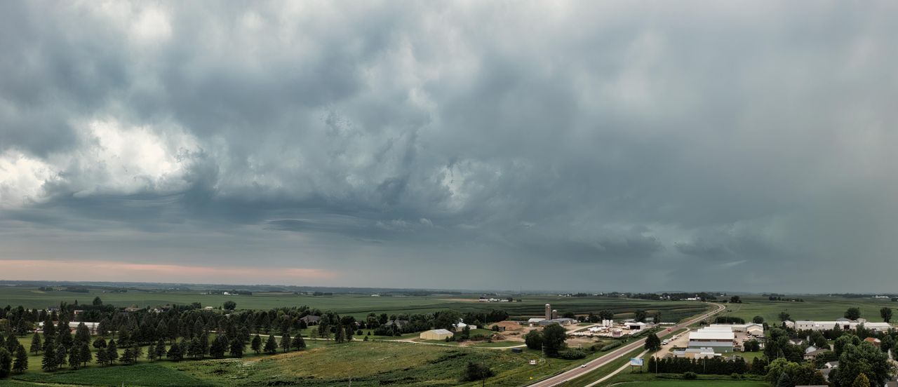
The National Weather Service’s Storm Prediction Center said millions of people from parts of the Plains into the Midwest face an elevated risk as a volatile spring storm system strengthens and thunderstorms begin to develop through the afternoon and evening.
Forecasters warn of an unusually dangerous setup
Meteorologists said the greatest concern centers on a corridor stretching from parts of Kansas and Oklahoma into Nebraska, Missouri and Iowa, where warm, moisture-rich air from the Gulf is colliding with a powerful upper-level storm system and a sharpening dryline. That combination is expected to create an environment favorable for fast-developing supercells capable of producing large hail and tornadoes.
The Storm Prediction Center issued a high-end severe weather outlook, a comparatively uncommon forecast designation used when confidence is growing in widespread significant severe storms. Such alerts are closely watched because they often signal the possibility of long-track tornadoes, particularly when wind shear and atmospheric instability rise together over a broad area.
Forecasters said daytime heating, increasing humidity and strengthening winds at multiple levels of the atmosphere were expected to intensify through Monday afternoon. Those ingredients can help thunderstorms rotate, increasing the risk that some storms become tornadic and remain dangerous for hours as they move across populated areas.
National Weather Service offices across the region urged residents to closely monitor watches and warnings and to have multiple ways to receive emergency alerts. Officials stressed that severe weather could continue after dark, a factor that often increases danger because tornadoes are harder to see and people may be asleep when warnings are issued.
Areas at greatest risk span the Plains and Midwest
The core threat zone includes parts of central and eastern Kansas, northern Oklahoma, southeastern Nebraska, western and central Missouri and southern Iowa, though severe storms are expected to extend beyond that area. Large metropolitan areas, smaller cities and rural communities alike could be affected as storms race northeastward through the evening.
Weather officials said the exact corridor of the most intense tornado activity would depend on where storms first form and whether they remain isolated long enough to tap into the strongest instability. If that happens, individual supercells could produce very large hail, intense wind gusts and tornadoes rated EF2 or stronger on the Enhanced Fujita scale.
Farther south and east, additional areas from Arkansas into Illinois also face the potential for severe thunderstorms, though the primary hazards may vary by location and storm mode. In some places, storms could cluster into lines, shifting the main threat toward widespread damaging winds while still maintaining a risk of embedded tornadoes.
Emergency management agencies across several states said they were reviewing staffing and warning procedures ahead of the outbreak. School districts, hospitals, nursing homes and businesses in vulnerable areas were urged to review shelter plans, as rapid storm development can leave little time to react once tornado warnings are issued.
Why this storm system is different from a typical spring outbreak
Spring tornado outbreaks are not unusual in the central United States, but forecasters said Monday’s setup stands out because multiple atmospheric ingredients are expected to overlap at a high level over a wide geographic area. A deepening surface low, strong jet stream winds and abundant low-level moisture are combining to create a classic environment for dangerous severe weather.
Meteorologists often focus on instability, wind shear and lift when assessing tornado potential. In this case, forecast models indicated robust instability from warm surface temperatures and rich humidity, while powerful winds aloft were expected to increase speed and directional shear, helping storms organize and rotate efficiently.
Another concern is the presence of a strong low-level jet expected to intensify toward evening. That feature can increase the likelihood of tornadoes after sunset by transporting additional moisture northward and enhancing the spin available to thunderstorms, even after daytime heating begins to fade.
Forecasters also noted that the system may support both discrete supercells and later clusters of storms, extending the danger over many hours. The combination of long-track tornado potential early and widespread wind damage later is one reason weather officials have emphasized the seriousness of the threat and urged the public not to focus on a single hazard.
Residents urged to prepare before storms arrive
Officials advised people in the risk area to identify the safest place in their home, workplace or school before storms begin. The best shelter is typically a basement or a small interior room on the lowest floor, away from windows, with mobile homes and vehicles considered unsafe in tornado warnings.
The National Weather Service and local emergency managers said residents should make sure they can receive alerts from more than one source, including smartphone warnings, weather radios and local broadcasters. Sirens, officials noted, are meant to alert people outdoors and should not be relied on as the only warning method inside homes.
People were also urged to review plans for pets, medications and essential documents in case they need to move quickly to shelter. Those living in manufactured housing or in areas with limited shelter options were encouraged to arrange in advance to stay with friends, family or at a sturdier location if watches are issued.
Travelers across the region were told to be alert to rapidly changing conditions on roads and interstates, especially during the evening commute. Storms moving at highway speeds can overtake motorists quickly, and officials warned that trying to outrun a tornado by car is dangerous, particularly when visibility is reduced by rain or darkness.
Severe weather season is entering a critical period
Monday’s threat comes during the heart of the U.S. severe weather season, when warmer temperatures and stronger spring storm systems frequently collide across the Plains and Midwest. Climatologically, May is one of the busiest months for tornado activity, though the intensity and location of outbreaks can vary sharply from year to year.
In recent years, forecasters have emphasized that high-end tornado days remain relatively rare even in the most active regions, which is why a strongly worded outlook draws such close public attention. While not every area in a broad risk zone will see a tornado, the events that do occur on these days can be exceptionally destructive and life-threatening.
Weather experts say public response in the hours before storms arrive can make a critical difference in outcomes. Knowing where to shelter, keeping phones charged and avoiding delays when warnings are issued can save lives, especially during nighttime events when minutes matter most.
Forecasters said they would continue refining the outlook as new observations and radar trends emerge through Monday. For residents in the central United States, the message remained consistent: treat the threat seriously, stay weather-aware all day and be prepared to take shelter immediately if warnings are issued.